
West Covina 🇺🇸
-
Nautical Twilight begins:05:40 amSunrise:06:33 am
-
Sunset:07:01 pmNautical Twilight ends:07:54 pm
-
Moonrise:-
-
Moonset:02:33 pm
-
Moon over:06:59 am
-
Moon under:07:19 pm
-
Visibility:46%
-
 Third Quarter Moon
-
Distance to earth:367,282 kmProximity:90.2 %
Moon Phases for West Covina
-
average Day
-
major Time:
 05:59 am -
07:59 am
05:59 am -
07:59 am
-
minor Time:01:33 pm - 03:33 pm
-
major Time:
06:19 pm -
08:19 pm
-
minor Time:11:06 pm - 01:06 am
Tide Clock
Tide Graph
Times
| Tide | Time | Height |
|---|---|---|
| high | 06:02 am | 3.18 ft |
| low | 08:10 am | 3.12 ft |
| high | 03:23 pm | 5.22 ft |
| low | 11:41 pm | 0.16 ft |
| Date | Major Bite Times | Minor Bite Times | Sun | Moon | Moonphase | Tide Times |
|---|---|---|---|---|---|---|
|
Sun, 14 Sep
|
05:59 am -
07:59 am
06:19 pm -
08:19 pm
|
01:33 pm -
03:33 pm
11:06 pm -
01:06 am
|
R: 06:33 am S: 07:01 pm |
R: - S: 02:33 pm |
Third Quarter Moon |
high: 06:02 am
, 3.18 ft
, Coeff: 37
low: 08:10 am
, 3.12 ft
high: 03:23 pm
, 5.22 ft
, Coeff: 112
low: 11:41 pm
, 0.16 ft
|
|
Mon, 15 Sep
|
06:48 am -
08:48 am
07:21 pm -
09:21 pm
|
02:31 pm -
04:31 pm
11:06 pm -
01:06 am
|
R: 06:34 am S: 06:59 pm |
R: 12:06 am S: 03:31 pm |
Third Quarter Moon |
high: 07:15 am
, 3.61 ft
, Coeff: 53
low: 10:46 am
, 3.22 ft
high: 04:59 pm
, 5.25 ft
, Coeff: 113
|
|
Tue, 16 Sep
|
07:44 am -
09:44 am
08:18 pm -
10:18 pm
|
12:12 am -
02:12 am
03:17 pm -
05:17 pm
|
R: 06:35 am S: 06:58 pm |
R: 01:12 am S: 04:17 pm |
Waning Crescent |
low: 12:46 am
, -0.13 ft
high: 07:49 am
, 3.97 ft
, Coeff: 66
low: 12:19 pm
, 2.85 ft
high: 06:14 pm
, 5.48 ft
, Coeff: 121
|
|
Wed, 17 Sep
|
08:38 am -
10:38 am
09:12 pm -
11:12 pm
|
01:20 am -
03:20 am
03:57 pm -
05:57 pm
|
R: 06:36 am S: 06:57 pm |
R: 02:20 am S: 04:57 pm |
Waning Crescent |
low: 01:35 am
, -0.36 ft
high: 08:17 am
, 4.3 ft
, Coeff: 78
low: 01:17 pm
, 2.36 ft
high: 07:12 pm
, 5.68 ft
, Coeff: 128
|
|
Thu, 18 Sep
|
09:28 am -
11:28 am
10:00 pm -
12:00 am
|
02:27 am -
04:27 am
04:29 pm -
06:29 pm
|
R: 06:36 am S: 06:55 pm |
R: 03:27 am S: 05:29 pm |
Waning Crescent |
low: 02:13 am
, -0.39 ft
high: 08:43 am
, 4.56 ft
, Coeff: 87
low: 02:02 pm
, 1.87 ft
high: 07:59 pm
, 5.74 ft
, Coeff: 131
|
|
Fri, 19 Sep
|
10:13 am -
12:13 pm
10:44 pm -
12:44 am
|
03:30 am -
05:30 am
04:57 pm -
06:57 pm
|
R: 06:37 am S: 06:54 pm |
R: 04:30 am S: 05:57 pm |
Waning Crescent |
low: 02:46 am
, -0.3 ft
high: 09:07 am
, 4.82 ft
, Coeff: 97
low: 02:41 pm
, 1.44 ft
high: 08:40 pm
, 5.68 ft
, Coeff: 128
|
|
Sat, 20 Sep
|
10:57 am -
12:57 pm
11:26 pm -
01:26 am
|
04:32 am -
06:32 am
05:22 pm -
07:22 pm
|
R: 06:38 am S: 06:52 pm |
R: 05:32 am S: 06:22 pm |
New Moon |
low: 03:14 am
, -0.1 ft
high: 09:30 am
, 5.02 ft
, Coeff: 104
low: 03:17 pm
, 1.12 ft
high: 09:17 pm
, 5.48 ft
, Coeff: 121
|


uploaded by: Stephen Spencer

uploaded by: Jon “Kuse”

uploaded by: Elzen Harris

uploaded by: RAMason69

uploaded by: Steven Butcheck

uploaded by: Joey Piercefield

uploaded by: Hoza

uploaded by: John Matthews

uploaded by: JoEllen Disterhaupt

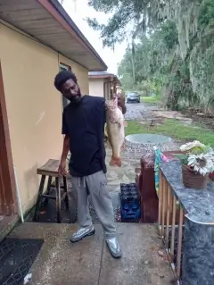
uploaded by: JoEllen Disterhaupt
West Covina,Zapadna Kovina,Zapadnaja Kovina,Западна Ковина,Западная Ковина
Best Fishing Spots in the greater West Covina area
We found a total of 45 potential fishing spots nearby West Covina. Below you can find them organized on a map. Points, Headlands, Reefs, Islands, Channels, etc can all be productive fishing spots. As these are user submitted spots, there might be some errors in the exact location. You also need to cross check local fishing regulations. Some of the spots might be in or around marine reserves or other locations that cannot be fished. If you click on a location marker it will bring up some details and a quick link to google search, satellite maps and fishing times. Tip: Click/Tap on a new area to load more fishing spots.
Santa Fe Dam - 6km , Hacienda Channel - 8km , San Jose Creek Diversion Channel - 8km , Legg Lake - 12km , Greenleaf 18 Dam - 12km , Puddingstone 32-009 Dam - 12km , Sawpit Debris Dam - 12km , Morris Dam - 13km , Morris 35-005 Dam - 13km , Sawpit 32-012 Dam - 13km , Sawpit Dam - 13km , Whittier Reservoir Number 4 18-002 Dam - 13km , Santa Anita Debris Dam - 14km , Big Dalton Debris Dam - 14km , Whittier Narrows Dam - 14km , Little Dalton Debris Dam - 14km , Santa Anita Dam - 15km , Sierra Madre Dam - 15km , Weymouth Memorial Reservoir 35-011 Dam - 15km , Live Oak Reservoir 35-013 Dam - 15km , Puddingstone Diversion Dam - 16km , Puddingstone Diversion 32-016 Dam - 16km , Orange County Reservoir 35-007 Dam - 16km , Morris S Jones 19-003 Dam - 16km , Bailey Debris Dam - 16km , Carter Debris Dam - 16km , Garvey 35-006 Dam - 16km , 30 Mg Central Reservoir 1087 Dam - 16km , Big Dalton 32-000 Dam - 16km , Newman Point - 17km , Sorensen Avenue Drain - 17km , Sierra Madre Villa Debris Dam - 17km , Chino Ranch Number 1 2025 Dam - 17km , San Gabriel Dam - 17km , Eaton Wash Dam - 18km , San Dimas 32-010 Dam - 18km , Laguna Lake - 18km , Live Oak Canyon Dam - 19km , Twomile Point - 19km , Brea Dam - 20km , Cogswell Dam - 20km , Cogswell 32-005 Dam - 20km , Fullerton Dam - 20km , Carbon Canyon Dam - 20km , Little Lake (historical) - 20km
Comments